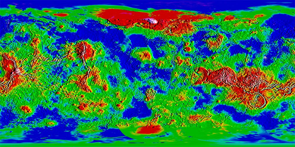
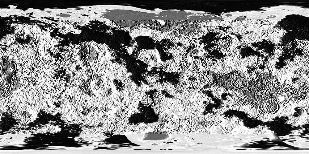
How would you, for instance, transform this topological map of Venus into one with normal sea/land borders?
Venus doesn't have an ocean of course, so the answer to my question might be quite complex. How would you do it assuming different sea levels? Is that possible?
Transforming a topological map into a traditional one?
Moderator: Cartographers
9 posts
• Page 1 of 1
Re: Transforming a topological map into a traditional one?
I have almost no experience with graphics software, but as I understand it, you can select by colour, so if you were to select everything from red through green as land, and cyan through violet as ocean, I think it would be a start. With a selection, you should be able to create an outline which would be your shores. Erase insignificantly small islands and you have a good start. After that, make use of the natural highlands as impassables. Breaking up open areas is a bit more problematic, but I have seen comments in the Foundry that suggest that when creating maps of imaginary areas (fantasy or sci-fi) the terrain can suggest where habitation would occur most readily (natural harbours, box valleys, etc.) and that territories grow from these points.
-

 ender516
- Posts: 4455
- Joined: Wed Dec 17, 2008 6:07 pm
- Location: Waterloo, Ontario


Re: Transforming a topological map into a traditional one?
there might be something useful here. viewtopic.php?f=63&t=109272&start=45#p2452052

-

 porkenbeans
- Posts: 2546
- Joined: Mon Sep 10, 2007 4:06 pm


Re: Transforming a topological map into a traditional one?
For starters you need to figure out what your threshold will be for land and sea. Right now you have a lot of shades of green and blue so exactly where your coastlines lie is really hard to pinpoint. My first move would be to drive this down to a few simpler colors by adjusting the levels - this gave me the added benefit of really highlighting where my mountains are going to go.
Looking back at this I probably didn't push it enough, but you get the idea. From here it's easier to start creating you continent layers... you could duplicate the layer, make it grayscale and drive it to line if you really wanted to simplify things. On the image below, black is water, everything else is land. Select your water, select inverse, and you've got your land selected.
If that looks like not enough water, just go back and adjust layers to different levels until you like the balance. This was all about 15 seconds worth of work.

-

 oaktown
- Posts: 4451
- Joined: Sun Dec 03, 2006 9:24 pm
- Location: majorcommand


Re: Transforming a topological map into a traditional one?
Simply changing it to black and white may not work since the luminosity seems to be constant, only the hue is changing...
Thus, I would simply transfer the hue channel to the luminosity channel to get it into a black and white height map. I'd take a few copies of that height map layer and put one aside as a spare. Then I would apply emboss/engrave on the layer - perhaps a few times on various depth settings to achieve an adjustable texture. Then I'd just put those layers on overlay with various opacities on top of the colour layer.
I'd take that spare height map layer, then apply a luminosity curve and select some few of the bottom levels - say the first hundred (my software uses a 0-255 scale) - and set them to zero. Then I'd use the magic wand with tolerance 0 to select all the black on that layer (all the colour we just set to zero) and I'd have a selection of the heights from 0 to 100, then I'd just fill that area with blue to make it into ocean.

-

 natty dread
- Posts: 12877
- Joined: Fri Feb 08, 2008 8:58 pm
- Location: just plain fucked


Re: Transforming a topological map into a traditional one?
Ok here's what I got... didn't do anything fancy graphically, just a start with green land area and blue ocean... just a proof-of-concept if you will.
here's also the height map I made, someone might find it useful. In this image, black represents top height, while white represents bottom.
here's also the height map I made, someone might find it useful. In this image, black represents top height, while white represents bottom.

-

 natty dread
- Posts: 12877
- Joined: Fri Feb 08, 2008 8:58 pm
- Location: just plain fucked


Re: Transforming a topological map into a traditional one?
oaktown wrote:For starters you need to figure out what your threshold will be for land and sea. Right now you have a lot of shades of green and blue so exactly where your coastlines lie is really hard to pinpoint. My first move would be to drive this down to a few simpler colors by adjusting the levels - this gave me the added benefit of really highlighting where my mountains are going to go.
Looking back at this I probably didn't push it enough, but you get the idea. From here it's easier to start creating you continent layers... you could duplicate the layer, make it grayscale and drive it to line if you really wanted to simplify things. On the image below, black is water, everything else is land. Select your water, select inverse, and you've got your land selected.
If that looks like not enough water, just go back and adjust layers to different levels until you like the balance. This was all about 15 seconds worth of work.
What do you mean by levels? I see Levels in Adjustments, but that doesn't seem to be what you're talking about (I'm using CS3 btw).
natty_dread: looks great, I'll try out that technique later
-

 InkL0sed
- Posts: 2370
- Joined: Sat Jun 23, 2007 4:06 pm
- Location: underwater


-

 natty dread
- Posts: 12877
- Joined: Fri Feb 08, 2008 8:58 pm
- Location: just plain fucked


Re: Transforming a topological map into a traditional one?
Glad to see some real cartographers chiming in here. I knew the sort of thing to be done (pretty much what natty has whipped up), but didn't have the specific knowledge of the tools.
I hope this map has some success, but I fear it may go the way of the Mars maps that have taken this route. Perhaps a map that works like the Land and Sea map? That one is intriguing, and this picture reminds me of it somewhat.
I hope this map has some success, but I fear it may go the way of the Mars maps that have taken this route. Perhaps a map that works like the Land and Sea map? That one is intriguing, and this picture reminds me of it somewhat.
-

 ender516
- Posts: 4455
- Joined: Wed Dec 17, 2008 6:07 pm
- Location: Waterloo, Ontario


9 posts
• Page 1 of 1
Who is online
Users browsing this forum: No registered users


