shakeycat wrote:It really is a small number of territories (39) to go extra large like this. This isn't like Tisha's First Nations which combined two already large maps into one. Instead, it's taking a medium sized England map and just moving the territories a little further from each other, with a huge graphic-heavy border. Most of the extra space is just for flashy graphics. We do not all work on huge monitors: I play on my laptop, and newer laptops have screens wider and shorter than my own, which are even worse for a map like this. Is it possible to fit it within the 840x800 large size?
i do all my work on a 15.6'' laptop at a resolution of 1400*900 or on another laptop with 1366*768 resolution. if i can actually design a map on that display then i can surely play it with no problem.
shakeycat wrote:A smaller size would be more appropriate with the current setup. There aren't many "nothing" territories. They're almost all part of the machine, which would make for quick and dirty play, almost like the Doodle Earth of specialty maps. I certainly wouldn't play Doodle Earth XL edition.
i have no idea what you mean by dirty but quick surely is what i have in mind. i originally intended this map to have even less terits in the range of 18-24.
the fact that you wouldn't play it doesn't make it bad. in fact doodle earth has a huge amount of games so i guess some people do want fast battles.
shakeycat wrote:I'm wondering now why there isn't a minimum territory limit for extra-large maps?
because teritory count has nothing to do with map size. i could fit a 100 terit map in 500*500 with absolute ease if i make a simple 10*10 square. and at the same time i might need a supersize map if i chose to make a map of a long thin coutry like chile.
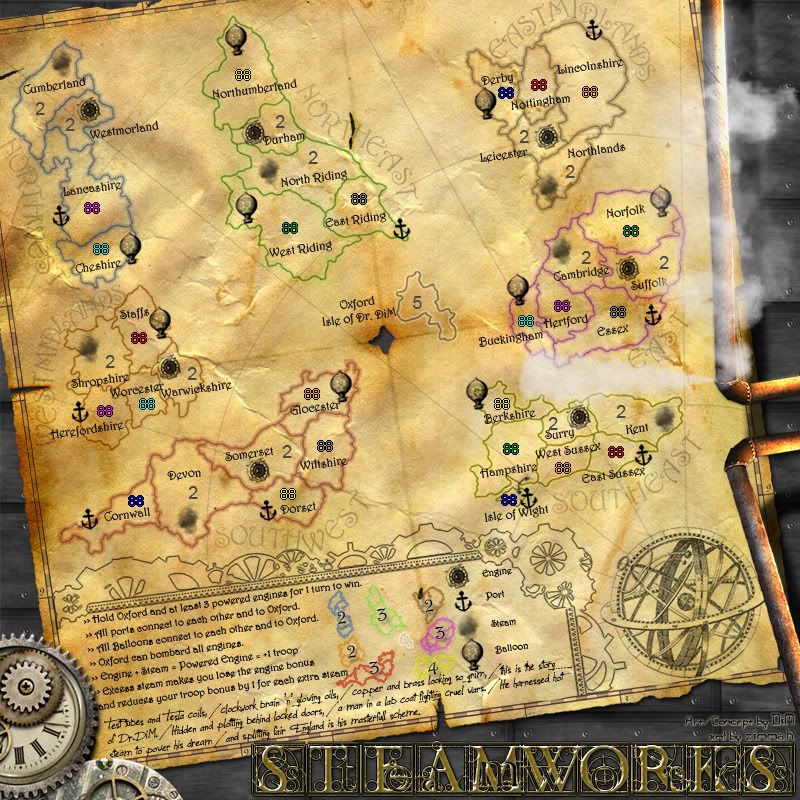
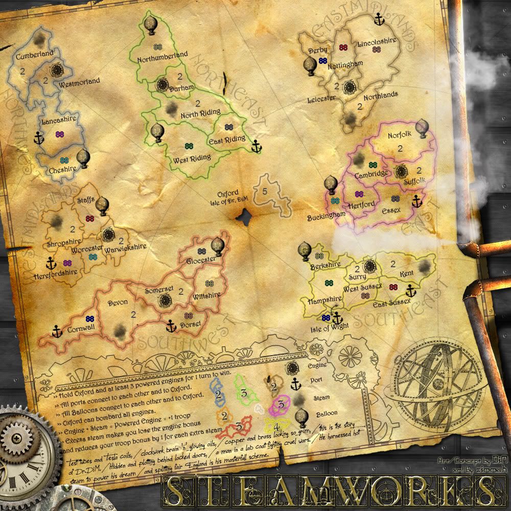
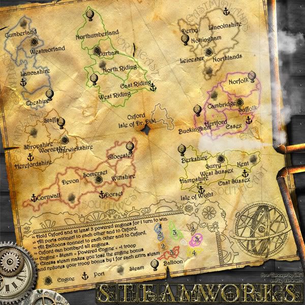
shakeycat wrote:If it does stay extra large, make it worthwhile and explain why England is busted apart. Is it now broken into islands surrounded by water, or is it just a disconnected map? Is there anything in between these sections of England (islands, fragmented pieces of land/dust/sandbars, steampunky trade boats, vessels headed to/from India)? Could we expand the sections a bit and add some more territories - cities, resources, trains (stations), factories, horse-drawn carriages, Queen Victoria herself - something! There must be some huge element of the Age of Steam that would be apt to include.
it seems like you just skipped to the end of the thread without looking to all the posts. no problem.
i said at least 2 times that i plan on adding various artwork like steamships and waves and stuff between the islands.
i haven't bothered to do it yet because frankly if i add those final touchups i don't know what else i could do for this map. the gameplay seems set, the graphics would be almost final, heck, zimmah almost finished the xml too. and all i have is a draft badge. what do i do then? just sit around and wait?
and yes i can probably fit this map in 800*800. i can simply forget about the steamships and waves and bring the continents so close that the sea looks like rivers. i can get rid of the pipes and steam and fancy title and just leave the old paper with the cramped up continents on it. that surely would fit but it would also look so crappy i'd rather abandon it.
“In the beginning God said, the four-dimensional divergence of an antisymmetric, second rank tensor equals zero, and there was light, and it was good. And on the seventh day he rested.”- Michio Kaku


