Re: Thailand (draft2)
griff, you should know by now to post updates to both ends of the thread... it's annoying to jump back to pg1 
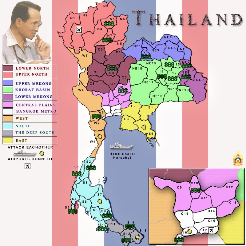
- Click image to enlarge.
Conquer Club, a free online multiplayer variation of a popular world domination board game.
https://www.conquerclub.com/forum/
https://www.conquerclub.com/forum/viewtopic.php?f=358&t=100058
natty_dread wrote:Anyway, I think you will have problems with the small version... there are a few territories that look too small to be legible in the small version...
A good trick is trying to fit army numbers that are 133% the normal size on the map. This way you'll know if the army numbers will fit once the map is shrunk into 3/4 the size.
Industrial Helix wrote:
Gameplay wise, this map looks like a nightmare to play. There is very little by way of choke points and if I were to play it, I'd feel like I have no strategy other than chance. I'd say add some impassables and fudge some of the borders to make the Bangkok region more important... see the Mexico draft so see what I mean.
Industrial Helix wrote:The ship... I think I like it. I'd rather see more reliance on the ship to round out gameplay rather than airports.
Industrial Helix wrote:The names, South, North, South West ect. ought to go. Put something Thai in there.
grifftron wrote:natty_dread wrote:Anyway, I think you will have problems with the small version... there are a few territories that look too small to be legible in the small version...
A good trick is trying to fit army numbers that are 133% the normal size on the map. This way you'll know if the army numbers will fit once the map is shrunk into 3/4 the size.
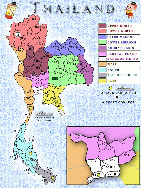
which terts? Because i have seen CC maps that have been quenched where the digis don't even fit in the tert / or overlap the tert boarders... If this really is an issue i could resize the map now to an 800x800 or a little larger, i am at 800hx600w at the moment...
just an example of a CC map and over lapping boarders with digi circles.
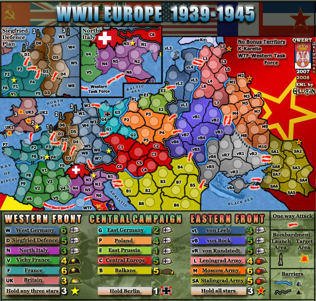
so is this gonna be an issue or what? cuz WWII_Europe seems to work just fine with its tiny terts.
-griff
The Bison King wrote:Whose this weirdo? I miss the boys.

My point is, just because you are creating an image of a real place or object, does not mean that you are required to view it from the overhead, looking straight down.

Not all of a sudden really, just that the past couple of days there has been two maps that have been started. Both subjects have been ones that people have been afraid to touch, because of the "skinny" shape.The Bison King wrote:My point is, just because you are creating an image of a real place or object, does not mean that you are required to view it from the overhead, looking straight down.
Why are you really into this idea all of a sudden?
porkenbeans wrote:You have a whole lot of empty "water" space. So I would suggest that you start with all of the interior territs, then after you have them the way that you want, lay in the coastal territs. The bulk of them, (if not all), can go in the water. Places like S5 will NOT be a problem, as there is plenty of space in the water right next to it. I think that it will be fine if you just make sure that at least the numbers fit into those coastal territs. The labels can swim.
Also you can stretch the width of the image a bit, so as to increase the land area some. So long as it remains recognizable as Thailand, you can get away with it.
The Bison King wrote:I think you should combine some territories in certain regions.
For example c18 and c19 could be united, as well as c10 and c11
It would free up space and some of those territories are a little extraneous.
Victor Sullivan wrote:Are there reasons behind dividing the territories as you did? Will each of them have legitimate names or will they just be letters and numbers?
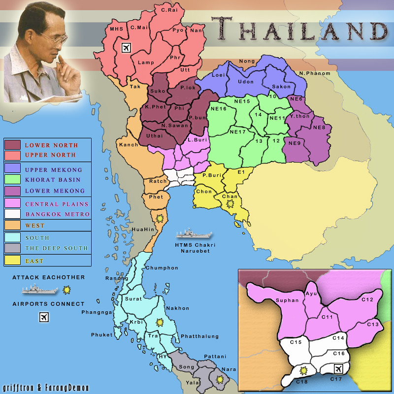

porkenbeans wrote:Griff, can you re-post the image with "big image" tags ?
That way the avatar will not cover it up, in the upper right.
sure.
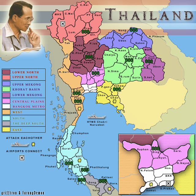
About the labels,
They look great, but I would really like to see the full names, (instead of abbreviations). I realize that some of the names are rather long, but unless there is no available space, I believe that this map is screaming for the full name. You have a whole lot of space available outside of the Thailand perimeter, so all of those territs that are on that perimeter, have plenty of space for their full name. I would only use abbreviations, on the interior territs, that are too small for the full names.
yep ok, Farang is correcting some of the names right now and has sent me a list already so i will add that to the next update.
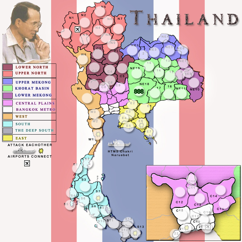
Also, can you post a large and/or small version. The extra large is not helping, to properly visualize the map. we need to see what the text looks like in its actual size.
I work with flickr... the offer diff sizes of each picture you d/l... can i just use the 640x640 i will post it below.. otherwise i can just resize it in photoshop.. use this for now i guess..
Keep on keepin on, it's looking really good.