CUSTERS LAST STAND
Moderator: Cartographers
Forum rules
Please read the Community Guidelines before posting.
Please read the Community Guidelines before posting.

CUSTERS LAST STAND
Hey... How about a little bighorn map? Sounds cool....
Re: CUSTERS LAST STAND
not really doable, if you want it historically accurate at all. the whole battle was just too chaotic to chart in any way linear enough to turn in to a battle map.

Re: CUSTERS LAST STAND
petrie000 wrote:not really doable, if you want it historically accurate at all. the whole battle was just too chaotic to chart in any way linear enough to turn in to a battle map.
While choas makes mapping difficult, there's no reason that some semblance of the battle couldn't be represented...
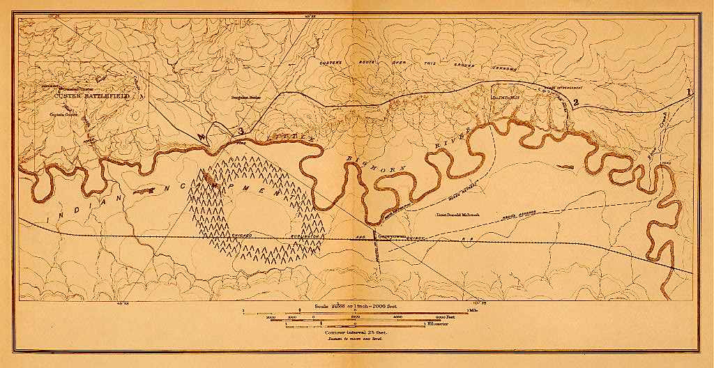
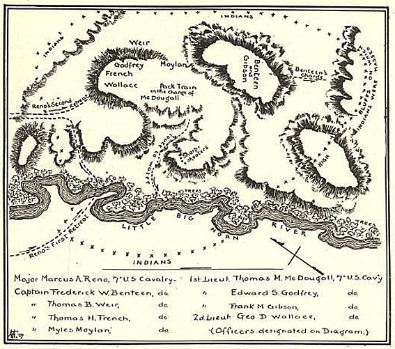
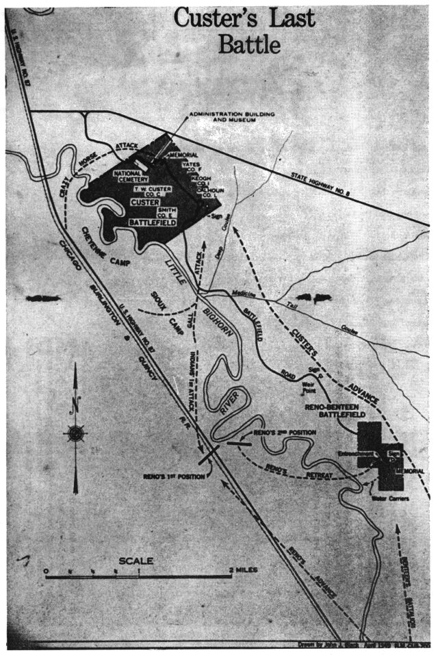
I've found a couple of maps that could be used for inspiration:
http://www-cgsc.army.mil/carl/resources/csi/sioux/IMAGES/MAP23.GIF
http://www.sonofthesouth.net/union-generals/custer/pictures/map-custer-last-stand.jpg
http://www.sonofthesouth.net/union-generals/custer/pictures/little-big-horn-battle-map.jpg
http://samilitaryhistory.org/vo032rma.jpg

PB: 2661 | He's blue... If he were green he would die | No mod would be stupid enough to do that
Re: CUSTERS LAST STAND
i'm not slamming the idea, just as an amateur history buff i was saying that a historically accurate map wouldn't be very practical. if someone wants to run with the idea, they'll have to take a few creative liberties, but that's just fine by me.
Re: CUSTERS LAST STAND
Custers last stand where he fell & most of the 7th cav was mainly in one area. it could be done